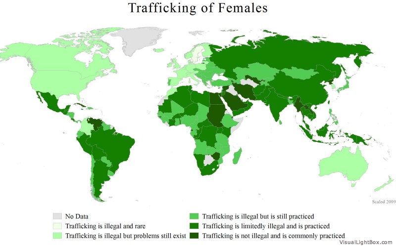
Category Archives: Maps

Freedom of the Press Index 2013

Freedom of the Press Index 2013

Reporters Without Borders released this week its freedom of the press report for 2013. According to the report, countries where press freedoms are curtailed the most are Turkmenistan, North Korea, Eritrea. In contrast, the countries where freedom of the press is respected the most are Finland, the Netherlands, and Norway. The map above shows the state of world press freedoms for 2013.

Chicago: A City of Guns

click to enlargeChicago is the only city in the United States with tough gun control laws. Gun shops are prohibited, and so are shootings ranges. It is illegal for private citizens to carry guns in public places. Despite this fact, Chicago has experienced a high number of gun-related deaths, 500 homicides in 2012 and so far 40 in the first month of 2013.

Guns recovered by the Chicago police in the last twelve years came mainly from the within the state of Illinois, followed by the states of Indiana, Mississippi, Wisconsin, Kentucky, Ohio, Tennessee, Alabama, Arkansas and Texas. Overall, the provenance of guns confiscated in Chicago pointed to all 50 states, Puerto Rico and Guam.

Resource: The New York Times: Where 50,000 Guns Recovered in Chicago Came From


Road Fatalities in the US

The map above provides a sobering look at road fatalities in the US. Created by ITO World using the Fatality Analysis Reporting System of the National Highway Traffic Safety Administration, the map shows virtually every single fatality that occurred in the roads of the United States as a result of a vehicle collision between 2001 and 2009. You can zoom in to read details about each fatality.

Prostitution Policy by Country

click to enlarge

Prostitution is defined as the practice of providing sexual services to another individual in exchange for payment.

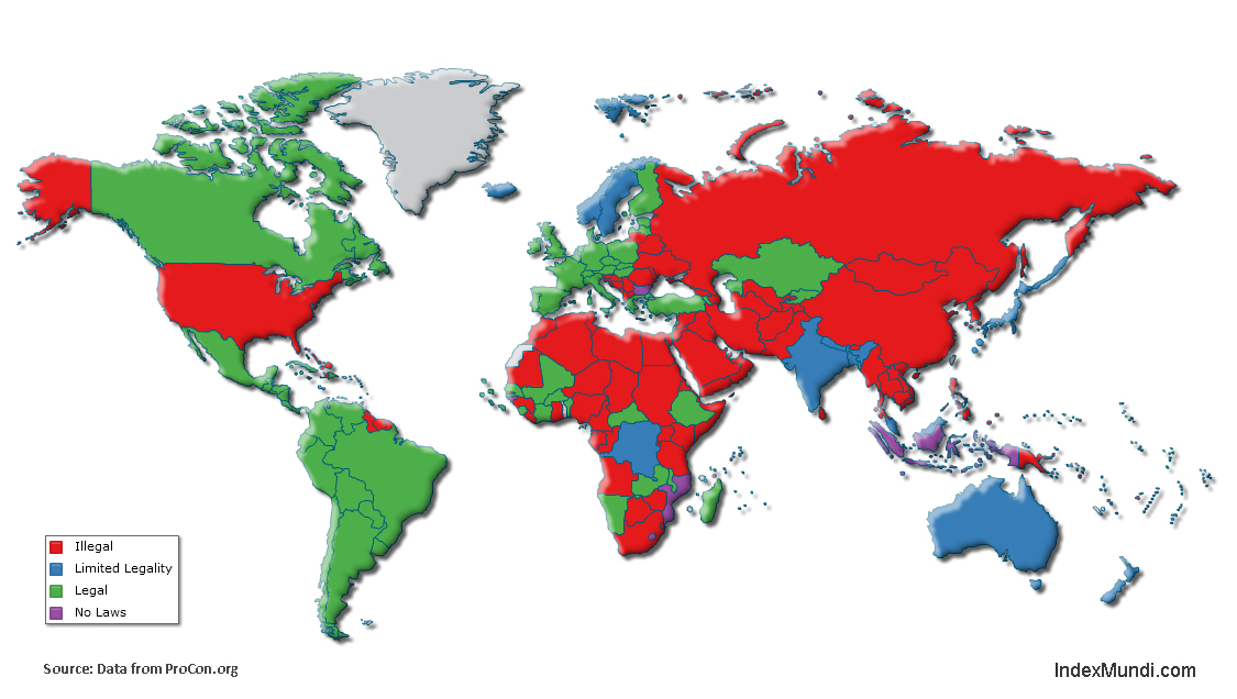
The legal status of prostitution varies from country to country. In some countries the practice is legal and regulated like in the case of Germany, Brazil, Netherlands, Canada, Argentina, Indonesia and Singapore, to name a few. In others it is illegal, with extreme cases where it is punishable by death. In the United States prostitution is illegal, except for 11 counties in the state of Nevada. As seen in the map above, it is illegal in most countries.

Some countries have a limited legality policy such as in the case of Australia, where prostitution is legal in most of the country, except in Southern Australia where its practice is restricted. Other countries with limited legality include Bangladesh, Democratic Republic of the Congo, Iceland, India, Japan, Malaysia, Nepal, New Zealand, Norway and Sweden.

There are no laws regarding prostitution in countries like Bulgaria, Guinea-Bissau, Indonesia, Lesotho and Mozambique.

For more details visit: ProCon.org: 100 Countries and Their Prostitution Policies


Traffic Deaths by Country

Traffic deaths by country

Traffic deaths per 100K people

Approximately 1.3 million people die each year on the world’s roads, according to the 2009 Global Status Report on Road Safety published by the World Health Organization (WHO). Using data from the report, we created the two maps shown above. The first map shows the total number of road traffic deaths by country. The map shows that India (105 thousand) and China (96 thousand) have the highest number of road traffic deaths, which is not surprising given their large populations and large number of registered vehicles. It is worth noting though that while there were approximately 145 million registered vehicles in China in 2009, the total for India was only 72 million. In other words, India had a much higher rate of road traffic deaths per registered vehicle than China.

The second map shows the number of road traffic deaths per 100,000 inhabitants. The largest rates of road traffic deaths occur in Eritrea (48.4), Egypt (41.6), and Libya (40.5). The map also shows that relatively high rates of road traffic deaths occur in many countries in Africa and the Middle East.

Age of Marriage by Country

Practice of child marriage for girls by country

We return to the excellent WomanStats Project to share a map they created illustrating which countries allow marriage of girls who are under 16 years of age. You’ll notice from the map that there are many countries in Africa where underage marriage is common. Other regions of the world where the practice is widespread include the Middle East, South and Southeast Asia, and Oceania.

Laconic History of the World

Laconic history of the World

Martin Elmer created the fantastically entertaining world map shown above using Wikipedia. Each country in the map is represented by the most frequently used word in every Wikipedia article entitled “History of ___”. The results are somewhat predictable in many cases, as in having the word Soviet as the most common word in the History of Russia article (172 occurrences as of today), or the word Kim in the History of North Korea article (68 occurrences). Other results are perhaps a little bit less predictable, and yet they still make a lot of sense for those familiar with the history of each nation. Zoom in on Europe and you’ll quickly realize that War is the most frequent word for almost all countries in Western Europe. Which is the most common word in the corresponding article for your country?

Trafficking of Females

trafficking of females

Although statistics about trafficking of females are unreliable due to a number of reasons, starting with the clandestine nature of the activity, the WomanStats Project has managed to gather one of the most comprehensive data sets to date about the issue. One of the maps they produced, displayed above, illustrates the magnitude of the problem worldwide. You may find it shocking that in this day and age trafficking is not illegal and is even common in several countries, including Egypt, Sudan, Saudi Arabia, and Iran. To find out more about the issue, and find out what you can do to help, visit the Stop Violence Against Women site.

Record Warm Temperatures Registered in 2012

click to enlarge

Temperatures for the U.S. contiguous states in 2012 were 1 degree Fahrenheit warmer than the previous record temperatures of 1998. Based on preliminary data the National Oceanic and Atmospheric Administration (NOOA) created the map above, where it can be clearly seen that across the nation warmer temperatures were registered. Nineteen states from Massachusetts to Utah, experienced record warmer temperatures.

2012 was also a year of record low levels of precipitation, below average. Drier than average conditions affected the central parts of the United States, with negative consequences for agriculture. The winter season 2011-2012 was affected by higher than normal warm temperatures as well.


It Is Flu Time!

Right now it is flu season in the northern hemisphere. The flu (influenza) is a contagious respiratory disease caused by influenza viruses.

Google Trends created the map shown above, based on aggregate data generated by users searching for the word “flu” and related terms, in order to estimate flu activity worldwide. According to data captured by Google Trends, flu activity is very intense in the U.S. at the moment. Canada, Russia, Norway, Poland, the Netherlands and Japan show high flu activity as well.


The Centers for Disease Control and Prevention (CDC) tracks the geographical spread of flu across the United States, however, the collected data does not reflect intensity of influenza activity.

As can be seen in the map, the flu has spread relatively quickly in the last three weeks throughout the continental United States. California, Mississippi and the District of Columbia show local influenza activity at the moment.