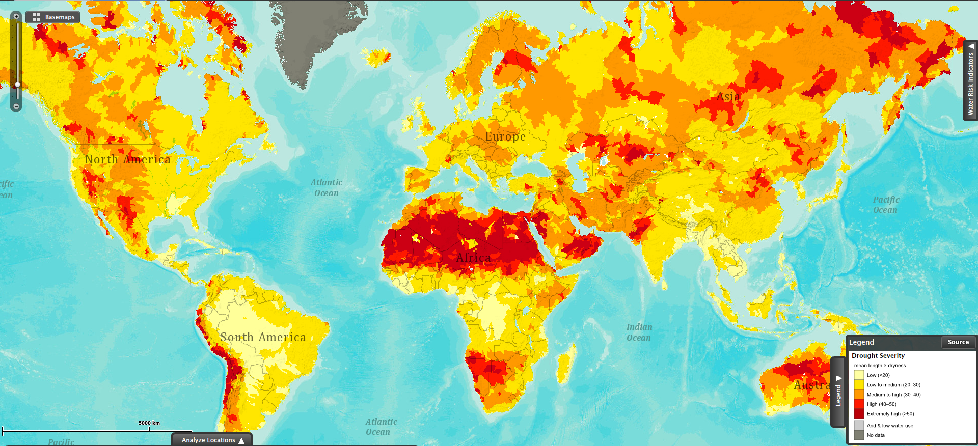
 This map shows drought severity, measured as the product of the average length of a drought occurrence and how dry it was the drought. This visualization is based on data collected for the period between 1901 and 2008.
The red areas in the map show the regions most severely affected by droughts. The northern region of the African continent stands out as the largest area being affected by severe droughts. Southwestern Africa (Namibia and Botswana) has also been severely affected by droughts in the same period.
Some areas in the Andean region in South America (Ecuador, Peru, Bolivia, Chile and Argentina) have also suffered the effects of severe droughts during the past century.
Parts of Australia and Russia have also been affected by extreme drought conditions.
Sources:
- World Resources Institute: Aqueduct – Atlas: Water Risk Interactive Map
- World Resources Institute: Working Paper: Aqueduct Metadata Document – Aqueduct Global Maps 2.0