Saint Helena, Ascension and Tristan da Cunha |
|---|
|
|
Anthem: "God Save the Queen"
|
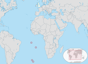 Location of Saint Helena, Ascension and Tristan da Cunha (circled in red) |
| Sovereign state | United Kingdom |
|---|
| Saint Helena colonial charter | 1657 |
|---|
| Crown colony | 22 April 1834[1] |
|---|
| Ascension added | 12 September 1922 |
|---|
| Tristan da Cunha added | 12 January 1938 |
|---|
| Current constitution | 1 September 2009 |
|---|
| Capital | Jamestown
15°56′S05°43′W / 15.933°S 5.717°W / -15.933; -5.717 |
|---|
| Largest city | Half Tree Hollow
15°56′0″S5°43′12″W / 15.93333°S 5.72000°W / -15.93333; -5.72000 |
|---|
| Official languages | English |
|---|
| Government | Devolvedself-governingdependencies under a constitutional monarchy |
|---|
|
| Elizabeth II |
|---|
| Philip Rushbrook |
|---|
| Sean Burns |
|---|
| Fiona Kilpatrick and Stephen Townsend (job share) |
|---|
| Tariq Ahmad |
|---|
|
| Area |
|---|
• Total | 394 km2 (152 sq mi) |
|---|
| Highest elevation | 6,765 ft (2,062 m) |
|---|
| Population |
|---|
• 2016 census | 5,633[2] (not ranked) |
|---|
• Density | 13.4/km2 (34.7/sq mi) (not ranked) |
|---|
| Currency | Saint Helena pound (£) (SHP) (Saint Helena and Ascension)
Pound sterling (£) (GBP) |
|---|
| Time zone | UTC±00:00 (GMT) |
|---|
| Date format | dd/mm/yyyy |
|---|
| Driving side | left |
|---|
| Calling code | +290(Saint Helena and Tristan da Cunha)
+247(Ascension)
+44 20(Tristan da Cunha) |
|---|
| UK postcode | STHL 1ZZ (Saint Helena)
ASCN 1ZZ (Ascension)
TDCU 1ZZ (Tristan da Cunha) |
|---|
| ISO 3166 code | SH |
|---|
| Internet TLD | |
|---|