Sint Maarten |
|---|
|
|
Motto(s): "Semper progrediens" (Latin)(English: "Always progressing") |
Anthem: "O Sweet Saint Martin's Land"
|
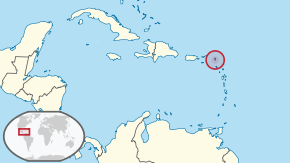 Location of Sint Maarten (circled in red) |
 Sint Maarten is located on the southern half of
the island of Saint Martin. |
| Sovereign state | Kingdom of the Netherlands |
|---|
| Before separation | Netherlands Antilles |
|---|
| Country status | 10 October 2010 |
|---|
| Capital | Philipsburg
18°02′N63°03′W / 18.033°N 63.050°W / 18.033; -63.050 |
|---|
| Largest city | Lower Prince's Quarter |
|---|
| Official languages | |
|---|
| Demonym(s) | St. Maartener |
|---|
| Government | Parliamentaryrepresentative democracy within a constitutional monarchy |
|---|
|
| Willem-Alexander |
|---|
| Eugene Holiday |
|---|
| Silveria Jacobs |
|---|
|
| Legislature | Estates of Sint Maarten |
|---|
| Area |
|---|
• Total | 34[2] km2 (13 sq mi) |
|---|
| Highest elevation | 383 m (1,257 ft) |
|---|
| Population |
|---|
• 1 January 2019 estimate | 41,486[2] (216th) |
|---|
• Density | 1,221/km2 (3,162.4/sq mi) (10th) |
|---|
| GDP (PPP) | 2014 estimate |
|---|
• Total | $365.8 million[3] |
|---|
• Per capita | $8.817,43[4] |
|---|
| Currency | Netherlands Antillean guilder (United States dollar also accepted) (ANG) |
|---|
| Time zone | UTC-4:00 (AST) |
|---|
| Mains electricity | 120 V–60 Hz |
|---|
| Driving side | right |
|---|
| Calling code | +1-721 |
|---|
| ISO 3166 code | |
|---|
| Internet TLD | .sx |
|---|


