Anguilla |
|---|
|
|
| Motto: "Unity, Strength and Endurance" |
| Anthem: "God Save the Queen" |
| National song: "God Bless Anguilla" |
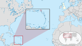 Location of Anguilla (red) |
 |
| Sovereign state | United Kingdom |
|---|
| English control | 1667 |
|---|
| Federation with Saint Kitts and Nevis | 1871 |
|---|
| Secession and independence | 12 July 1967 |
|---|
| British control restored | 18 March 1969 |
|---|
| Capital and largest city | The Valley |
|---|
| Official languages | English |
|---|
| Ethnic groups (2011) | 85.3% Black
4.9% Hispanic
3.8% Multiracial
3.2% White
1% Indian
1.9% other[1] |
|---|
| Demonym(s) | Anguillan (Natives call themselves Anguillian) |
|---|
| Government | Parliamentarydependency under a constitutional monarchy |
|---|
|
| Elizabeth II |
|---|
| Dileeni Daniel-Selvaratnam |
|---|
• Deputy Governor | Perin A. Bradley |
|---|
| Ellis Webster |
|---|
|
| Legislature | House of Assembly |
|---|
|
• Minister | Tariq Ahmad |
|---|
|
• Total | 91 km2 (35 sq mi) |
|---|
• Water (%) | negligible |
|---|
| Highest elevation | 240 ft (73 m) |
|---|
|
• 2018 estimate | 14,731[2][3] (not ranked) |
|---|
• 2011 census | 13,452 |
|---|
• Density | 132/km2 (341.9/sq mi) (not ranked) |
|---|
| GDP (PPP) | 2014 estimate |
|---|
• Total | $311 million[4] |
|---|
• Per capita | $29,493 |
|---|
| GDP (nominal) | 2020 estimate |
|---|
• Total | US$307,000,000[5] |
|---|
| Currency | Eastern Caribbean dollar (XCD) |
|---|
| Time zone | UTC–4 (AST) |
|---|
| Date format | dd/mm/yyyy |
|---|
| Driving side | left |
|---|
| Calling code | +1-264 |
|---|
| UK postcode | AI-2640 |
|---|
| ISO 3166 code | AI |
|---|
| Internet TLD | .ai |
|---|


_-_AIA_-_UNOCHA.svg)