Northern Mariana Islands |
|---|
|
Commonwealth of the Northern Mariana Islands
Sankattan Siha Na Islas Mariånas (Chamorro)
Commonwealth Téél Falúw kka Efáng llól Marianas (Carolinian) |
|
Anthem:"Gi Talo Gi Halom Tasi" (Chamorro)
"Satil Matawal Pacifiko" (Carolinian)
("In the Middle of the Sea") |
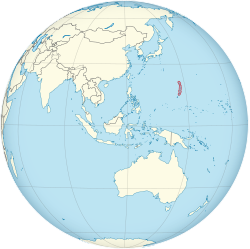 Location of the Northern Mariana Islands
(circled in red) |
| Sovereign state | United States |
|---|
| Before union with U.S. | Trust Territory of the Pacific Islands |
|---|
| Commonwealth Status | January 9, 1978 |
|---|
| End of U.N. Trusteeship | November 4, 1986 |
|---|
| Capital and largest city | Saipan
15°11′N145°44′E / 15.19°N 145.74°E / 15.19; 145.74 |
|---|
| Official languages | |
|---|
| Ethnic groups | |
|---|
| Religion | |
|---|
| Demonym(s) | Northern Mariana Islander (formal)
Mariana (diminutive form)
Chamorro (colloquial)[3] |
|---|
| Government | Devolvedpresidential constitutional dependency |
|---|
|
| Ralph Torres (R) |
|---|
| Arnold Palacios (R) |
|---|
|
| Legislature | Commonwealth Legislature |
|---|
| Senate |
|---|
| House of Representatives |
|---|
|
| Gregorio Sablan (I) |
|---|
|
• Total | 464[4][5] km2 (179 sq mi) |
|---|
• Water (%) | negligible |
|---|
| Highest elevation | 3,166 ft (965 m) |
|---|
|
• 2021 estimate | 51,659[6] (209th) |
|---|
• Density | 113/km2 (292.7/sq mi) (97th) |
|---|
| GDP (PPP) | 2016 estimate |
|---|
• Total | $1.24 billion[6] |
|---|
• Per capita | $24,500[6] |
|---|
| GDP (nominal) | 2019 estimate |
|---|
• Total | US$1,182,000,000[7] |
|---|
| Currency | United States dollar (US$) (USD) |
|---|
| Time zone | UTC+10:00 (ChST) |
|---|
| Date format | mm/dd/yyyy |
|---|
| Driving side | right |
|---|
| Calling code | +1-670 |
|---|
| USPS abbreviation | MP |
|---|
| Trad. abbreviation | CNMI |
|---|
| ISO 3166 code | |
|---|
| Internet TLD | .mp |
|---|
| Website | gov.mp |
|---|


_(small_islands_magnified).svg)