
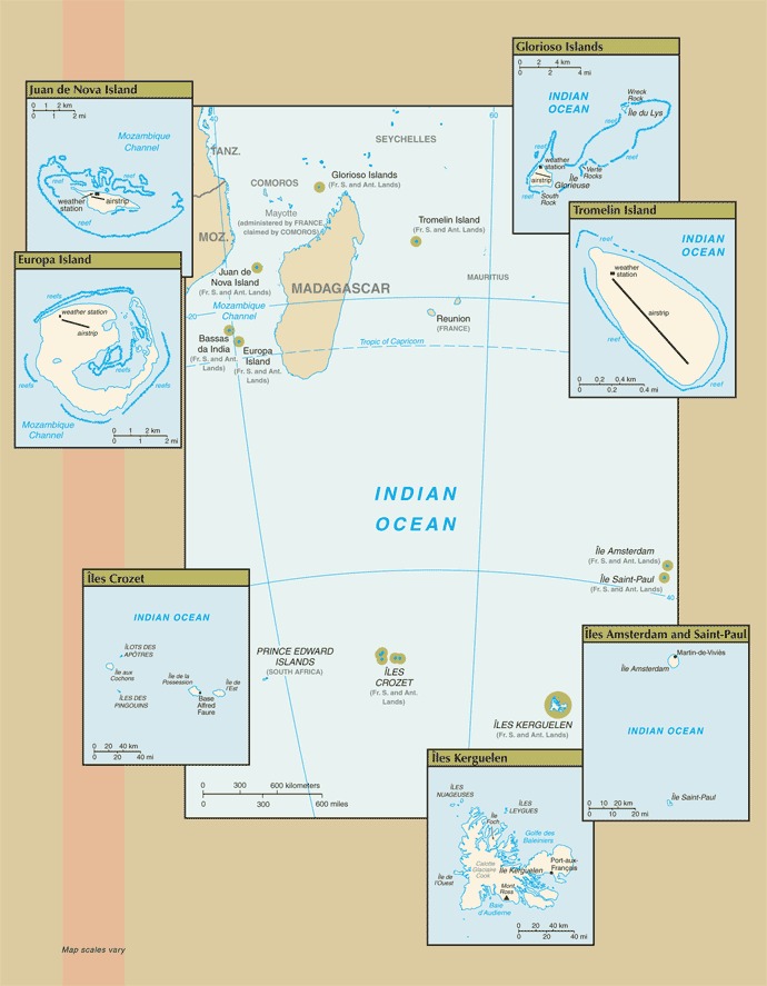
Ile Amsterdam (Ile Amsterdam et Ile Saint-Paul): 37 50 S, 77 32 E;
Ile Saint-Paul (Ile Amsterdam et Ile Saint-Paul): 38 72 S, 77 53 E;
Iles Crozet: 46 25 S, 51 00 E;
Iles Kerguelen: 49 15 S, 69 35 E;
Bassas da India (Iles Eparses): 21 30 S, 39 50 E;
Europa Island (Iles Eparses): 22 20 S, 40 22 E;
Glorioso Islands (Iles Eparses): 11 30 S, 47 20 E;
Juan de Nova Island (Iles Eparses): 17 03 S, 42 45 E;
Tromelin Island (Iles Eparses): 15 52 S, 54 25 E
Definition: This entry includes rounded latitude and longitude figures for the centroid or center point of a country expressed in degrees and minutes; it is based on the locations provided in the Geographic Names Server (GNS), maintained by the National Geospatial-Intelligence Agency on behalf of the US Board on Geographic Names.
Source: CIA World Factbook - This page was last updated on Saturday, September 18, 2021