
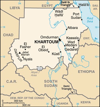
border countries (7): Central African Republic 174 km, Chad 1403 km, Egypt 1276 km, Eritrea 682 km, Ethiopia 744 km, Libya 382 km, South Sudan 2158 km
note: Sudan-South Sudan boundary represents 1 January 1956 alignment; final alignment pending negotiations and demarcation; final sovereignty status of Abyei region pending negotiations between Sudan and South Sudan
Definition: This entry contains the total length of all land boundaries and the individual lengths for each of the contiguous border countries. When available, official lengths published by national statistical agencies are used. Because surveying methods may differ, country border lengths reported by contiguous countries may differ.
Source: CIA World Factbook - This page was last updated on Saturday, September 18, 2021