Slovak Republic |
|---|
|
Anthem: "Nad Tatrou sa blýska"
(English: "Lightning Over the Tatras") |
National seal
|
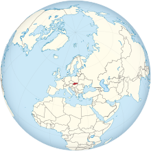 Show globe Show globe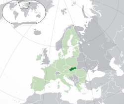 Show map of Europe Show map of Europe |
| Capital and largest city | Bratislava
48°09′N17°07′E / 48.150°N 17.117°E / 48.150; 17.117 |
|---|
| Official languages | Slovak |
|---|
| Ethnic groups | |
|---|
| Religion | |
|---|
| Demonym(s) | Slovak |
|---|
| Government | Unitaryparliamentaryconstitutionalrepublic |
|---|
|
| Zuzana Čaputová |
|---|
| Eduard Heger |
|---|
| Boris Kollár |
|---|
|
| Legislature | National Council |
|---|
|
|
| 28 October 1918 |
|---|
| 1 January 1969 |
|---|
| 23 April 1990 |
|---|
• Independent Slovak Republic | 1 January 1993 |
|---|
|
|
• Total | 49,035 km2 (18,933 sq mi) (127th) |
|---|
• Water (%) | 0.72 (as of 2015)[3] |
|---|
|
• 2020 estimate |  5,464,060[4] (119th) 5,464,060[4] (119th) |
|---|
• 2011 census | 5,397,036 |
|---|
• Density | 111/km2 (287.5/sq mi) (88th) |
|---|
| GDP (PPP) | 2021 estimate |
|---|
• Total | $190.277 billion[5] (70th) |
|---|
• Per capita | $34,815[5] (41th) |
|---|
| GDP (nominal) | 2021 estimate |
|---|
• Total | $117.664 billion[5] (59st) |
|---|
• Per capita | $21,529[5] (40th) |
|---|
| Gini (2019) |  22.8[6] 22.8[6]
low |
|---|
| HDI (2019) | 0.860[7]
very high · 39th |
|---|
| Currency | Euro (€) (EUR) |
|---|
| Time zone | UTC+1 (CET) |
|---|
| UTC+2 (CEST) |
|---|
| Date format | dd/mm/yyyy |
|---|
| Driving side | right |
|---|
| Calling code | +421 |
|---|
| ISO 3166 code | SK |
|---|
| Internet TLD | .sk and .eu |
|---|


.svg)
