Republic of Cabo Verde
|
|---|
|
Motto: - Unidade, Trabalho, Progresso (Portuguese)
- (English: "Unity, Work, Progress")
|
|
 Show globe Show globe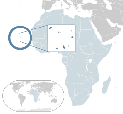 Show map of Africa Show map of Africa |
Capital
and largest city | Praia
14°55′N23°31′W / 14.917°N 23.517°W / 14.917; -23.517 |
|---|
| Official languages | Portuguese[1] |
|---|
| Recognised national languages | Cape Verdean Creole[1] |
|---|
| Religion | |
|---|
| Demonym(s) | Cape Verdean or Cabo Verdean[3] |
|---|
| Government | Unitarysemi-presidentialrepublic[4] |
|---|
|
| Jorge Carlos Fonseca |
|---|
| Ulisses Correia e Silva |
|---|
|
| Legislature | National Assembly |
|---|
| Formation |
|---|
|
| 5 July 1975 |
|---|
| 13 January 1990 |
|---|
|
| Area |
|---|
• Total | 4,033 km2 (1,557 sq mi) (166th) |
|---|
• Water (%) | negligible |
|---|
| Population |
|---|
• 2018 estimate | 543,767[5][6] (172nd) |
|---|
• Density | 123.7/km2 (320.4/sq mi) (89th) |
|---|
| GDP (PPP) | 2019 estimate |
|---|
• Total | $4.323 billion |
|---|
• Per capita | $7,728[7] |
|---|
| GDP (nominal) | 2019 estimate |
|---|
• Total | $2.042 billion |
|---|
• Per capita | $3,651[7] |
|---|
| Gini (2008) | 47.2[8]
high |
|---|
| HDI (2018) |  0.651[9] 0.651[9]
medium · 126th |
|---|
| Currency | Cape Verdean escudo (CVE) |
|---|
| Time zone | UTC–1 (CVT) |
|---|
| UTC–1 (not observed) |
|---|
| Driving side | right |
|---|
| Calling code | +238 |
|---|
| ISO 3166 code | CV |
|---|
| Internet TLD | .cv |
|---|


.svg)
