Republic of Benin |
|---|
|
Motto: - "Fraternité, Justice, Travail" (French)
- "Fraternity, Justice, Labour"
|
| Anthem: |
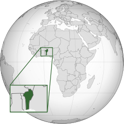 Location of Benin (dark green) |
| Capital | Porto-Novoa |
|---|
| Largest city | Cotonou |
|---|
| Official languages | French |
|---|
| National languages | |
|---|
| Ethnic groups | |
|---|
| Religion | |
|---|
| Demonym(s) | |
|---|
| Government | Unitarypresidentialrepublic |
|---|
|
| Patrice Talon |
|---|
| Mariam Chabi Talata |
|---|
|
| Legislature | National Assembly |
|---|
|
|
| 11 December 1958 |
|---|
| 1 August 1960 |
|---|
|
|
• Total | 114,763 km2 (44,310 sq mi)[3] (100th) |
|---|
• Water (%) | 0.4% |
|---|
|
• 2019 estimate | 11,733,059 (78th) |
|---|
• 2013 census | 10,008,749[4] |
|---|
• Density | 94.8/km2 (245.5/sq mi) (120th) |
|---|
| GDP (PPP) | 2019 estimate |
|---|
• Total | $29.918 billion[5] (137th) |
|---|
• Per capita | $2,552[5] (163rd) |
|---|
| GDP (nominal) | 2019 estimate |
|---|
• Total | $11.386 billion[5] (141st) |
|---|
• Per capita | $971[5] (163rd) |
|---|
| Gini (2015) |  47.8[6] 47.8[6]
high |
|---|
| HDI (2019) |  0.545[7] 0.545[7]
low · 158th |
|---|
| Currency | West African CFA franc (XOF) |
|---|
| Time zone | UTC+1 (WAT) |
|---|
| Driving side | right |
|---|
| Calling code | +229 |
|---|
| ISO 3166 code | BJ |
|---|
| Internet TLD | .bj |
|---|
|
|


.svg)